23.1.14. ベクタ一般
23.1.14.1. 投影法の割り当て
Assigns a new projection to a vector layer.
これが作成するのは、入力されたものとまったく同じ地物とジオメトリを持つ新しいレイヤですが、新しいCRSに割り当てられています。ジオメトリは再投影 されません 。異なるCRSに割り当てられるだけです。
このアルゴリズムは、誤った投影法が割り当てられたレイヤーを修復するために使用できます。
このアルゴリズムでは属性は変更されません。
23.1.14.1.1. パラメーター
ラベル |
名前 |
タイプ |
説明 |
|---|---|---|---|
Input layer |
|
[vector: any] |
Vector layer with wrong or missing CRS |
Assigned CRS |
|
[crs] Default: |
Select the new CRS to assign to the vector layer |
Assigned CRS (Optional) |
|
[same as input] Default: |
Specify the output layer containing only the duplicates. One of:
The file encoding can also be changed here. |
23.1.14.1.2. 出力
ラベル |
名前 |
タイプ |
説明 |
|---|---|---|---|
Assigned CRS |
|
[same as input] |
Vector layer with assigned projection |
23.1.14.1.3. Python code
Algorithm ID: qgis:assignprojection
import processing
processing.run("algorithm_id", {parameter_dictionary})
The algorithm id is displayed when you hover over the algorithm in the Processing Toolbox. The parameter dictionary provides the parameter NAMEs and values. See プロセシングアルゴリズムをコンソールから使う for details on how to run processing algorithms from the Python console.
23.1.14.2. 仮想ベクタの作成
複数のベクタレイヤを含む仮想ベクタレイヤを作成します。出力の仮想ベクタレイヤは現在のプロジェクトでは開きません。
このアルゴリズムは、他のアルゴリズムが複数のレイヤを必要としているが、レイヤが指定されている1つの vrt だけを受け入れる場合に特に便利です。
23.1.14.2.1. パラメーター
ラベル |
名前 |
タイプ |
説明 |
|---|---|---|---|
Input datasources |
|
[vector: any] [list] |
Select the vector layers you want to use to build the virtual vector |
Create "unioned" VRT |
|
[boolean] Default: False |
Check if you want to unite all the vectors in a
single |
Virtual vector |
|
[same as input] Default: |
Specify the output layer containing only the duplicates. One of:
The file encoding can also be changed here. |
23.1.14.2.2. 出力
ラベル |
名前 |
タイプ |
説明 |
|---|---|---|---|
Virtual vector |
|
[vector: any] |
The output virtual vector made from the chosen sources |
23.1.14.3. Convert layer to spatial bookmarks
Creates spatial bookmarks corresponding to the extent of features contained in a layer.
23.1.14.3.1. パラメーター
ラベル |
名前 |
タイプ |
説明 |
|---|---|---|---|
Input Layer |
|
[vector: line, polygon] |
The input vector layer |
Bookmark destination |
|
[enumeration] Default: 0 |
Select the destination for the bookmarks. One of:
|
Name field |
|
[expression] |
Field or expression that will give names to the generated bookmarks |
Group field |
|
[expression] |
Field or expression that will provide groups for the generated bookmarks |
23.1.14.3.2. 出力
ラベル |
名前 |
タイプ |
説明 |
|---|---|---|---|
Count of bookmarks added |
|
[number] |
23.1.14.3.3. Python code
Algorithm ID: qgis:layertobookmarks
import processing
processing.run("algorithm_id", {parameter_dictionary})
The algorithm id is displayed when you hover over the algorithm in the Processing Toolbox. The parameter dictionary provides the parameter NAMEs and values. See プロセシングアルゴリズムをコンソールから使う for details on how to run processing algorithms from the Python console.
23.1.14.4. Convert spatial bookmarks to layer
Creates a new layer containing polygon features for stored spatial bookmarks. The export can be filtered to only bookmarks belonging to the current project, to all user bookmarks, or a combination of both.
23.1.14.4.1. パラメーター
ラベル |
名前 |
タイプ |
説明 |
|---|---|---|---|
Bookmark source |
|
[enumeration] [list] Default: [0,1] |
Select the source(s) of the bookmarks. One or more of:
|
Output CRS |
|
[crs] Default: |
The CRS of the output layer |
出力 |
|
[vector: polygon] Default: |
Specify the output layer. One of:
The file encoding can also be changed here. |
23.1.14.4.2. 出力
ラベル |
名前 |
タイプ |
説明 |
|---|---|---|---|
出力 |
|
[vector: polygon] |
The output (bookmarks) vector layer |
23.1.14.4.3. Python code
Algorithm ID: qgis:bookmarkstolayer
import processing
processing.run("algorithm_id", {parameter_dictionary})
The algorithm id is displayed when you hover over the algorithm in the Processing Toolbox. The parameter dictionary provides the parameter NAMEs and values. See プロセシングアルゴリズムをコンソールから使う for details on how to run processing algorithms from the Python console.
23.1.14.5. Create attribute index
照会を高速化するために、属性テーブルのフィールドに対して索引を作成します。索引作成のサポートは、レイヤのデータプロバイダとフィールドタイプの両方によって異なります。
No outputs are created: the index is stored on the layer itself.
23.1.14.5.1. パラメーター
ラベル |
名前 |
タイプ |
説明 |
|---|---|---|---|
Input Layer |
|
[vector: any] |
Select the vector layer you want to create an attribute index for |
Attribute to index |
|
[tablefield: any] |
Field of the vector layer |
23.1.14.5.2. 出力
ラベル |
名前 |
タイプ |
説明 |
|---|---|---|---|
Indexed layer |
|
[same as input] |
A copy of the input vector layer with an index for the specified field |
23.1.14.5.3. Python code
Algorithm ID: qgis:createattributeindex
import processing
processing.run("algorithm_id", {parameter_dictionary})
The algorithm id is displayed when you hover over the algorithm in the Processing Toolbox. The parameter dictionary provides the parameter NAMEs and values. See プロセシングアルゴリズムをコンソールから使う for details on how to run processing algorithms from the Python console.
23.1.14.6. Create spatial index
空間的な位置に基づいてレイヤ内の地物へのアクセスを高速化するためのインデックスを作成します。空間インデックス作成のサポートは、レイヤのデータプロバイダによって異なります。
No new output layers are created.
Default menu:
23.1.14.6.1. パラメーター
ラベル |
名前 |
タイプ |
説明 |
|---|---|---|---|
Input Layer |
|
[vector: any] |
Input vector layer |
23.1.14.6.2. 出力
ラベル |
名前 |
タイプ |
説明 |
|---|---|---|---|
Indexed layer |
|
[same as input] |
A copy of the input vector layer with a spatial index |
23.1.14.6.3. Python code
Algorithm ID: qgis:createspatialindex
import processing
processing.run("algorithm_id", {parameter_dictionary})
The algorithm id is displayed when you hover over the algorithm in the Processing Toolbox. The parameter dictionary provides the parameter NAMEs and values. See プロセシングアルゴリズムをコンソールから使う for details on how to run processing algorithms from the Python console.
23.1.14.7. Define Shapefile projection
Sets the CRS (projection) of an existing Shapefile format dataset to
the provided CRS.
It is very useful when a Shapefile format dataset is missing the
prj file and you know the correct projection.
Contrary to the 投影法の割り当て algorithm, it modifies the current layer and will not output a new layer.
注釈
For Shapefile datasets, the .prj and .qpj files will
be overwritten - or created if missing - to match the provided CRS.
Default menu:
23.1.14.7.1. パラメーター
ラベル |
名前 |
タイプ |
説明 |
|---|---|---|---|
Input layer |
|
[vector: any] |
Vector layer with missing projection information |
CRS |
|
[crs] |
Select the CRS to assign to the vector layer |
23.1.14.7.2. 出力
ラベル |
名前 |
タイプ |
説明 |
|---|---|---|---|
|
[same as input] |
The input vector layer with the defined projection |
23.1.14.7.3. Python code
Algorithm ID: qgis:definecurrentprojection
import processing
processing.run("algorithm_id", {parameter_dictionary})
The algorithm id is displayed when you hover over the algorithm in the Processing Toolbox. The parameter dictionary provides the parameter NAMEs and values. See プロセシングアルゴリズムをコンソールから使う for details on how to run processing algorithms from the Python console.
23.1.14.8. Delete duplicate geometries
Finds and removes duplicated geometries.
属性はチェックされません。そのため、属性は違っても同じジオメトリを持つ地物は、一つしか出力されません。
23.1.14.8.1. パラメーター
ラベル |
名前 |
タイプ |
説明 |
|---|---|---|---|
Input layer |
|
[vector: any] |
The layer with duplicate geometries you want to clean |
Cleaned |
|
[same as input] Default: |
Specify the output layer. One of:
The file encoding can also be changed here. |
23.1.14.8.2. 出力
ラベル |
名前 |
タイプ |
説明 |
|---|---|---|---|
Count of discarded duplicate records |
|
[number] |
Count of discarded duplicate records |
Cleaned |
|
[same as input] |
The output layer without any duplicated geometries |
Count of retained records |
|
[number] |
Count of unique records |
23.1.14.8.3. Python code
Algorithm ID: qgis:deleteduplicategeometries
import processing
processing.run("algorithm_id", {parameter_dictionary})
The algorithm id is displayed when you hover over the algorithm in the Processing Toolbox. The parameter dictionary provides the parameter NAMEs and values. See プロセシングアルゴリズムをコンソールから使う for details on how to run processing algorithms from the Python console.
23.1.14.9. Delete duplicates by attribute
Deletes duplicate rows by only considering the specified field / fields. The first matching row will be retained, and duplicates will be discarded.
Optionally, these duplicate records can be saved to a separate output for analysis.
23.1.14.9.1. パラメーター
ラベル |
名前 |
タイプ |
説明 |
|---|---|---|---|
Input layer |
|
[vector: any] |
The input layer |
Fields to match duplicates by |
|
[tablefield: any] [list] |
Fields defining duplicates. Features with identical values for all these fields are considered duplicates. |
Filtered (no duplicates) |
|
[same as input] Default: |
Specify the output layer containing the unique features. One of:
The file encoding can also be changed here. |
Filtered (duplicates) (Optional) |
|
[same as input] Default: |
Specify the output layer containing only the duplicates. One of:
The file encoding can also be changed here. |
23.1.14.9.2. 出力
ラベル |
名前 |
タイプ |
説明 |
|---|---|---|---|
Filtered (duplicates) Optional |
|
[same as input] Default: |
Vector layer containing the removed features.
Will not be produced if not specified (left as
|
Count of discarded duplicate records |
|
[number] |
Count of discarded duplicate records |
Filtered (no duplicates) |
|
[same as input] |
Vector layer containing the unique features. |
Count of retained records |
|
[number] |
Count of unique records |
23.1.14.9.3. Python code
Algorithm ID: qgis:deleteduplicatesbyattribute
import processing
processing.run("algorithm_id", {parameter_dictionary})
The algorithm id is displayed when you hover over the algorithm in the Processing Toolbox. The parameter dictionary provides the parameter NAMEs and values. See プロセシングアルゴリズムをコンソールから使う for details on how to run processing algorithms from the Python console.
23.1.14.10. Drop geometries
入力レイヤ属性テーブルの単純な ジオメトリのない コピーを作成します。ソースレイヤの属性テーブルを保持します。
If the file is saved in a local folder, you can choose between many file formats.
 Allows features in-place modification
23.1.14.10.1. パラメーター
ラベル |
名前 |
タイプ |
説明 |
|---|---|---|---|
Input layer |
|
[vector: any] |
The input vector layer |
Dropped geometries |
|
[table] |
Specify the output geometryless layer. One of:
The file encoding can also be changed here. |
23.1.14.10.2. 出力
ラベル |
名前 |
タイプ |
説明 |
|---|---|---|---|
Dropped geometries |
|
[table] |
The output geometryless layer. A copy of the original attribute table. |
23.1.14.10.3. Python code
Algorithm ID: qgis:dropgeometries
import processing
processing.run("algorithm_id", {parameter_dictionary})
The algorithm id is displayed when you hover over the algorithm in the Processing Toolbox. The parameter dictionary provides the parameter NAMEs and values. See プロセシングアルゴリズムをコンソールから使う for details on how to run processing algorithms from the Python console.
23.1.14.11. Execute SQL
Runs a simple or complex query with SQL syntax on the source
layer.
Input datasources are identified with input1, input2... inputN and
a simple query will look like SELECT * FROM input1.
Beside a simple query, you can add expressions or variables within the
SQL query parameter itself. This is particulary useful if this algorithm is
executed within a Processing model and you want to use a model input as a
parameter of the query. An example of a query will then be SELECT * FROM
[% @table %] where @table is the variable that identifies the model input.
The result of the query will be added as a new layer.
23.1.14.11.1. パラメーター
ラベル |
名前 |
タイプ |
説明 |
|---|---|---|---|
Additional input datasources (called input1, .., inputN in the query) |
|
[vector: any] [list] |
問い合わせるレイヤのリスト。 SQLエディタでは、これらのレイヤを実際の名前でも参照できますし、選択したレイヤ数に応じて input1 、 input2 、 inputN でも参照できます。 |
SQL query |
|
[string] |
Type the string of your SQL query, e.g.
|
Unique identifier field Optional |
|
[string] |
Specify the column with unique ID |
Geometry field Optional |
|
[string] |
Specify the geometry field |
Geometry type Optional |
|
[enumeration] Default: 0 |
Choose the geometry of the result. By default the algorithm will autodetect it. One of:
|
CRS Optional |
|
[crs] |
The CRS to assign to the output layer |
SQL Output |
|
[vector: any] Default: |
Specify the output layer created by the query. One of:
The file encoding can also be changed here. |
23.1.14.11.2. 出力
ラベル |
名前 |
タイプ |
説明 |
|---|---|---|---|
SQL Output |
|
[vector: any] |
Vector layer created by the query |
23.1.14.11.3. Python code
Algorithm ID: qgis:executesql
import processing
processing.run("algorithm_id", {parameter_dictionary})
The algorithm id is displayed when you hover over the algorithm in the Processing Toolbox. The parameter dictionary provides the parameter NAMEs and values. See プロセシングアルゴリズムをコンソールから使う for details on how to run processing algorithms from the Python console.
23.1.14.12. Extract selected features
Saves the selected features as a new layer.
注釈
If the selected layer has no selected features, the newly created layer will be empty.
23.1.14.12.1. パラメーター
ラベル |
名前 |
タイプ |
説明 |
|---|---|---|---|
Input Layer |
|
[vector: any] |
Layer to save the selection from |
Selected features |
|
[same as input] Default: |
Specify the vector layer for the selected features. One of:
The file encoding can also be changed here. |
23.1.14.12.2. 出力
ラベル |
名前 |
タイプ |
説明 |
|---|---|---|---|
Selected features |
|
[same as input] |
Vector layer with only the selected features, or no feature if none was selected. |
23.1.14.12.3. Python code
Algorithm ID: qgis:saveselectedfeatures
import processing
processing.run("algorithm_id", {parameter_dictionary})
The algorithm id is displayed when you hover over the algorithm in the Processing Toolbox. The parameter dictionary provides the parameter NAMEs and values. See プロセシングアルゴリズムをコンソールから使う for details on how to run processing algorithms from the Python console.
23.1.14.13. Find projection
Creates a shortlist of candidate coordinate reference systems, for instance for a layer with an unknown projection.
The area that the layer is expected to cover must be specified via the target area parameter. The coordinate reference system for this target area must be known to QGIS.
The algorithm operates by testing the layer's extent in every known reference system and then listing any for which the bounds would be near the target area if the layer was in this projection.
23.1.14.13.1. パラメーター
ラベル |
名前 |
タイプ |
説明 |
|---|---|---|---|
Input Layer |
|
[vector: any] |
Layer with unknown projection |
Target area for layer (xmin, xmax, ymin, ymax) |
|
[extent] |
The area that the layer covers. The options for specifying the extent are:
It is also possible to provide the extent coordinates directly (xmin, xmax, ymin, ymax). |
CRS candidates |
|
[table] Default: |
Specify the table (geometryless layer) for the CRS suggestions (EPSG codes). One of:
The file encoding can also be changed here. |
23.1.14.13.2. 出力
ラベル |
名前 |
タイプ |
説明 |
|---|---|---|---|
CRS candidates |
|
[table] |
A table with all the CRS (EPSG codes) of the matching criteria. |
23.1.14.13.3. Python code
Algorithm ID: qgis:findprojection
import processing
processing.run("algorithm_id", {parameter_dictionary})
The algorithm id is displayed when you hover over the algorithm in the Processing Toolbox. The parameter dictionary provides the parameter NAMEs and values. See プロセシングアルゴリズムをコンソールから使う for details on how to run processing algorithms from the Python console.
23.1.14.14. Join attributes by field value
Takes an input vector layer and creates a new vector layer that is an extended version of the input one, with additional attributes in its attribute table.
追加の属性とその値は、2番目のベクトルレイヤから取得されます。結合基準を定義するために、それぞれで属性が選択されます。
23.1.14.14.1. パラメーター
ラベル |
名前 |
タイプ |
説明 |
|---|---|---|---|
Input Layer |
|
[vector: any] |
Input vector layer. The output layer will consist of the features of this layer with attributes from matching features in the second layer. |
Table field |
|
[tablefield: any] |
Field of the source layer to use for the join |
Input layer 2 |
|
[vector: any] |
Layer with the attribute table to join |
Table field 2 |
|
[tablefield: any] |
Field of the second (join) layer to use for the join The type of the field must be equal to (or compatible with) the input table field type. |
Layer 2 fields to copy Optional |
|
[tablefield: any] [list] |
Select the specific fields you want to add. By default all the fields are added. |
Join type |
|
[enumeration] Default: 1 |
The type of the final joined layer. One of:
|
Discard records which could not be joined |
|
[boolean] Default: True |
Check if you don't want to keep the features that could not be joined |
Joined field prefix Optional |
|
[string] |
Add a prefix to joined fields in order to easily identify them and avoid field name collision |
Joined layer |
|
[same as input] Default: |
Specify the output vector layer for the join. One of:
The file encoding can also be changed here. |
Unjoinable features from first layer |
|
[same as input] Default: |
Specify the output vector layer for unjoinable features from first layer. One of:
The file encoding can also be changed here. |
23.1.14.14.2. 出力
ラベル |
名前 |
タイプ |
説明 |
|---|---|---|---|
Number of joined features from input table |
|
[number] |
|
Unjoinable features from first layer Optional |
|
[same as input] |
Vector layer with the non-matched features |
Joined layer |
|
[same as input] |
Output vector layer with added attributes from the join |
Number of unjoinable features from input table Optional |
|
[number] |
23.1.14.14.3. Python code
Algorithm ID: qgis:joinattributestable
import processing
processing.run("algorithm_id", {parameter_dictionary})
The algorithm id is displayed when you hover over the algorithm in the Processing Toolbox. The parameter dictionary provides the parameter NAMEs and values. See プロセシングアルゴリズムをコンソールから使う for details on how to run processing algorithms from the Python console.
23.1.14.15. Join attributes by location
Takes an input vector layer and creates a new vector layer that is an extended version of the input one, with additional attributes in its attribute table.
追加の属性とその値は、第2のベクタレイヤから取得されます。第1のレイヤからの各地物に追加される第2のレイヤからの値を選択するために空間的基準が適用されます。
Default menu:
参考
Join attributes by nearest, Join attributes by field value, Join attributes by location (summary)
23.1.14.15.1. パラメーター
ラベル |
名前 |
タイプ |
説明 |
|---|---|---|---|
Input Layer |
|
[vector: any] |
Input vector layer. The output layer will consist of the features of this layer with attributes from matching features in the second layer. |
Join layer |
|
[vector: any] |
The attributes of this vector layer will be added to the source layer attribute table. |
Geometric predicate |
|
[enumeration] [list] Default: [0] |
Select the geometric criteria. One or more of:
|
Fields to add (leave empty to use all fields) Optional |
|
[tablefield: any] [list] |
Select the specific fields you want to add. By default all the fields are added. |
Join type |
|
[enumeration] |
The type of the final joined layer. One of:
|
Discard records which could not be joined |
|
[boolean] Default: False |
Remove from the output the input layer records which could not be joined |
Joined field prefix Optional |
|
[string] |
Add a prefix to joined fields in order to easily identify them and avoid field name collision |
Joined layer |
|
[same as input] Default: |
Specify the output vector layer for the join. One of:
The file encoding can also be changed here. |
Unjoinable features from first layer |
|
[same as input] Default: |
Specify the output vector layer for unjoinable features from first layer. One of:
The file encoding can also be changed here. |
23.1.14.15.2. 出力
ラベル |
名前 |
タイプ |
説明 |
|---|---|---|---|
Number of joined features from input table |
|
[number] |
|
Unjoinable features from first layer Optional |
|
[same as input] |
Vector layer of the non-matched features |
Joined layer |
|
[same as input] |
Output vector layer with added attributes from the join |
23.1.14.15.3. Python code
Algorithm ID: qgis:joinattributesbylocation
import processing
processing.run("algorithm_id", {parameter_dictionary})
The algorithm id is displayed when you hover over the algorithm in the Processing Toolbox. The parameter dictionary provides the parameter NAMEs and values. See プロセシングアルゴリズムをコンソールから使う for details on how to run processing algorithms from the Python console.
23.1.14.16. Join attributes by location (summary)
Takes an input vector layer and creates a new vector layer that is an extended version of the input one, with additional attributes in its attribute table.
追加の属性とその値は、第2のベクタレイヤから取得されます。第1のレイヤからの各地物に追加される第2のレイヤからの値を選択するために空間的基準が適用されます。
The algorithm calculates a statistical summary for the values from matching features in the second layer (e.g. maximum value, mean value, etc).
23.1.14.16.1. パラメーター
ラベル |
名前 |
タイプ |
説明 |
|---|---|---|---|
Input Layer |
|
[vector: any] |
Input vector layer. The output layer will consist of the features of this layer with attributes from matching features in the second layer. |
Join layer |
|
[vector: any] |
The attributes of this vector layer will be added to the source layer attribute table. |
Geometric predicate |
|
[enumeration] [list] Default: [0] |
Select the geometric criteria. One or more of:
|
Fields to summarize (leave empty to use all fields) Optional |
|
[tablefield: any] [list] |
Select the specific fields you want to add and summarize. By default all the fields are added. |
Summaries to calculate (leave empty to use all fields) Optional |
|
[enumeration] [list] Default: [] |
Choose which type of summary you want to add to each field and for each feature. One or more of:
|
Discard records which could not be joined |
|
[boolean] Default: False |
Remove from the output the input layer records which could not be joined |
Joined layer |
|
[same as input] Default: |
Specify the output vector layer for the join. One of:
The file encoding can also be changed here. |
23.1.14.16.2. 出力
ラベル |
名前 |
タイプ |
説明 |
|---|---|---|---|
Joined layer |
|
[same as input] |
Output vector layer with summarized attributes from the join |
23.1.14.16.3. Python code
Algorithm ID: qgis:joinbylocationsummary
import processing
processing.run("algorithm_id", {parameter_dictionary})
The algorithm id is displayed when you hover over the algorithm in the Processing Toolbox. The parameter dictionary provides the parameter NAMEs and values. See プロセシングアルゴリズムをコンソールから使う for details on how to run processing algorithms from the Python console.
23.1.14.17. Join attributes by nearest
Takes an input vector layer and creates a new vector layer with additional fields in its attribute table. The additional attributes and their values are taken from a second vector layer. Features are joined by finding the closest features from each layer.
By default only the nearest feature is joined, but the join can also join to the k-nearest neighboring features.
If a maximum distance is specified, only features which are closer than this distance will be matched.
参考
Nearest neighbour analysis, Join attributes by field value, Join attributes by location, Distance matrix
23.1.14.17.1. パラメーター
ラベル |
名前 |
タイプ |
説明 |
|---|---|---|---|
Input layer |
|
[vector: any] |
The input layer. |
Input layer 2 |
|
[vector: any] |
The join layer. |
Layer 2 fields to copy (leave empty to copy all fields) |
|
[fields] |
Join layer fields to copy (if empty, all fields will be copied). |
Discard records which could not be joined |
|
[boolean] Default: False |
Remove from the output the input layer records which could not be joined |
Joined field prefix |
|
[string] |
Joined field prefix |
Maximum nearest neighbors |
|
[number] Default: 1 |
Maximum number of nearest neighbors |
Maximum distance |
|
[number] |
Maximum search distance |
Joined layer |
|
[same as input] Default: |
Specify the vector layer containing the joined features. One of:
The file encoding can also be changed here. |
Unjoinable features from first layer |
|
[same as input] Default: |
Specify the vector layer containing the features that could not be joined. One of:
The file encoding can also be changed here. |
23.1.14.17.2. 出力
ラベル |
名前 |
タイプ |
説明 |
|---|---|---|---|
Joined layer |
|
[same as input] |
The output joined layer. |
Unjoinable features from first layer |
|
[same as input] |
Layer containing the features from first layer that could not be joined to any features in the join layer. |
Number of joined features from input table |
|
[number] |
Number of features from the input table that have been joined. |
Number of unjoinable features from input table |
|
[number] |
Number of features from the input table that could not be joined. |
23.1.14.17.3. Python code
Algorithm ID: qgis:joinbynearest
import processing
processing.run("algorithm_id", {parameter_dictionary})
The algorithm id is displayed when you hover over the algorithm in the Processing Toolbox. The parameter dictionary provides the parameter NAMEs and values. See プロセシングアルゴリズムをコンソールから使う for details on how to run processing algorithms from the Python console.
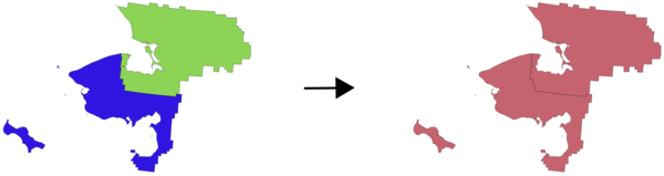
23.1.14.18. Merge vector layers
Combines multiple vector layers of the same geometry type into a single one.
If attributes tables are different, the attribute table of the resulting layer will contain the attributes from all input layers. Non-matching fields will be appended at the end of the attribute table.
If any input layers contain Z or M values, then the output layer will also contain these values. Similarly, if any of the input layers are multi-part, the output layer will also be a multi-part layer.
任意で、併合されるレイヤの目的座標参照系(CRS)を設定できます。設定されていない場合、CRSは最初の入力レイヤから取得されます。すべてのレイヤがこのCRSと一致するように再投影されます。
Default menu:
23.1.14.18.1. パラメーター
ラベル |
名前 |
タイプ |
説明 |
|---|---|---|---|
Input Layers |
|
[vector: any] [list] |
The layers that are to be merged into a single layer. Layers should be of the same geometry type. |
Destination CRS Optional |
|
[crs] |
Choose the CRS for the output layer. If not specified, the CRS of the first input layer is used. |
Merged |
|
[same as input] Default: |
Specify the output vector layer. One of:
The file encoding can also be changed here. |
23.1.14.18.2. 出力
ラベル |
名前 |
タイプ |
説明 |
|---|---|---|---|
Merged |
|
[same as input] |
Output vector layer containing all the features and attributes from the input layers. |
23.1.14.18.3. Python code
Algorithm ID: qgis:mergevectorlayers
import processing
processing.run("algorithm_id", {parameter_dictionary})
The algorithm id is displayed when you hover over the algorithm in the Processing Toolbox. The parameter dictionary provides the parameter NAMEs and values. See プロセシングアルゴリズムをコンソールから使う for details on how to run processing algorithms from the Python console.
23.1.14.19. Order by expression
式に従ってベクタレイヤをソートします:式に従って地物インデックスを変更します。
期待通りに機能しない可能性がありますので注意して下さい。順序が毎回維持されない場合があります。
23.1.14.19.1. パラメーター
ラベル |
名前 |
タイプ |
説明 |
|---|---|---|---|
Input Layer |
|
[vector: any] |
Input vector layer to sort |
Expression |
|
[expression] |
Expression to use for the sorting |
Sort ascending |
|
[boolean] Default: True |
If checked the vector layer will be sorted from small to large values. |
Sort nulls first |
|
[boolean] Default: False |
If checked, Null values are placed first |
Ordered |
|
[same as input] Default: |
Specify the output vector layer. One of:
The file encoding can also be changed here. |
23.1.14.19.2. 出力
ラベル |
名前 |
タイプ |
説明 |
|---|---|---|---|
Ordered |
|
[same as input] |
Output (sorted) vector layer |
23.1.14.19.3. Python code
Algorithm ID: qgis:orderbyexpression
import processing
processing.run("algorithm_id", {parameter_dictionary})
The algorithm id is displayed when you hover over the algorithm in the Processing Toolbox. The parameter dictionary provides the parameter NAMEs and values. See プロセシングアルゴリズムをコンソールから使う for details on how to run processing algorithms from the Python console.
23.1.14.20. Reproject layer
Reprojects a vector layer in a different CRS. The reprojected layer will have the same features and attributes of the input layer.
Allows features in-place modification
23.1.14.20.1. パラメーター
ラベル |
名前 |
タイプ |
説明 |
|---|---|---|---|
Input Layer |
|
[vector: any] |
Input vector layer to reproject |
Target CRS |
|
[crs] Default: |
Destination coordinate reference system |
Reprojected |
|
[same as input] Default: |
Specify the output vector layer. One of:
The file encoding can also be changed here. |
23.1.14.20.2. 出力
ラベル |
名前 |
タイプ |
説明 |
|---|---|---|---|
Reprojected |
|
[same as input] |
Output (reprojected) vector layer |
23.1.14.20.3. Python code
Algorithm ID: qgis:reprojectlayer
import processing
processing.run("algorithm_id", {parameter_dictionary})
The algorithm id is displayed when you hover over the algorithm in the Processing Toolbox. The parameter dictionary provides the parameter NAMEs and values. See プロセシングアルゴリズムをコンソールから使う for details on how to run processing algorithms from the Python console.
23.1.14.21. Set style for vector layer
Sets the style of a vector layer. The style must be defined in a QML file.
No new output are created: the style is immediately assigned to the vector layer.
23.1.14.21.1. パラメーター
ラベル |
名前 |
タイプ |
説明 |
|---|---|---|---|
Input Layer |
|
[vector: any] |
Input vector layer you want to set the style for |
Style file |
|
[file] |
|
23.1.14.21.2. 出力
ラベル |
名前 |
タイプ |
説明 |
|---|---|---|---|
Input Layer |
|
[same as input] |
The input vector layer with the new style |
23.1.14.21.3. Python code
Algorithm ID: qgis:setstyleforvectorlayer
import processing
processing.run("algorithm_id", {parameter_dictionary})
The algorithm id is displayed when you hover over the algorithm in the Processing Toolbox. The parameter dictionary provides the parameter NAMEs and values. See プロセシングアルゴリズムをコンソールから使う for details on how to run processing algorithms from the Python console.
23.1.14.22. Split features by character
Features are split into multiple output features by splitting a field's value at a specified character. For instance, if a layer contains features with multiple comma separated values contained in a single field, this algorithm can be used to split these values up across multiple output features. Geometries and other attributes remain unchanged in the output. Optionally, the separator string can be a regular expression for added flexibility.
23.1.14.22.1. パラメーター
ラベル |
名前 |
タイプ |
説明 |
|---|---|---|---|
Input Layer |
|
[vector: any] |
Input vector layer |
Split using values in the field |
|
[tablefield: any] |
Field to use for splitting |
Split value using character |
|
[string] |
Character to use for splitting |
Use regular expression separator |
|
[boolean] Default: False |
|
Split |
|
[same as input] Default: |
Specify output vector layer. One of:
The file encoding can also be changed here. |
23.1.14.22.2. 出力
ラベル |
名前 |
タイプ |
説明 |
|---|---|---|---|
Split |
|
[same as input] |
The output vector layer. |
23.1.14.22.3. Python code
Algorithm ID: qgis:splitfeaturesbycharacter
import processing
processing.run("algorithm_id", {parameter_dictionary})
The algorithm id is displayed when you hover over the algorithm in the Processing Toolbox. The parameter dictionary provides the parameter NAMEs and values. See プロセシングアルゴリズムをコンソールから使う for details on how to run processing algorithms from the Python console.
23.1.14.23. Split vector layer
Creates a set of vectors in an output folder based on an input layer and an attribute. The output folder will contain as many layers as the unique values found in the desired field.
The number of files generated is equal to the number of different values found for the specified attribute.
It is the opposite operation of merging.
Default menu:
23.1.14.23.1. パラメーター
ラベル |
名前 |
タイプ |
説明 |
|---|---|---|---|
Input Layer |
|
[vector: any] |
Input vector layer |
Unique ID field |
|
[tablefield: any] |
Field to use for splitting |
Output directory |
|
[folder] Default: |
Specify the directory for the output layers. One of:
The file encoding can also be changed here. |
23.1.14.23.2. 出力
ラベル |
名前 |
タイプ |
説明 |
|---|---|---|---|
Output directory |
|
[folder] |
The directory for the output layers |
Output layers |
|
[same as input] [list] |
The output vector layers resulting from the split. |
23.1.14.23.3. Python code
Algorithm ID: qgis:splitvectorlayer
import processing
processing.run("algorithm_id", {parameter_dictionary})
The algorithm id is displayed when you hover over the algorithm in the Processing Toolbox. The parameter dictionary provides the parameter NAMEs and values. See プロセシングアルゴリズムをコンソールから使う for details on how to run processing algorithms from the Python console.
23.1.14.24. Truncate table
Truncates a layer, by deleting all features from within the layer.
警告
This algorithm modifies the layer in place, and deleted features cannot be restored!
23.1.14.24.1. パラメーター
ラベル |
名前 |
タイプ |
説明 |
|---|---|---|---|
Input Layer |
|
[vector: any] |
Input vector layer |
23.1.14.24.2. 出力
ラベル |
名前 |
タイプ |
説明 |
|---|---|---|---|
Truncated layer |
|
[folder] |
The truncated (empty) layer |
23.1.14.24.3. Python code
Algorithm ID: qgis:truncatetable
import processing
processing.run("algorithm_id", {parameter_dictionary})
The algorithm id is displayed when you hover over the algorithm in the Processing Toolbox. The parameter dictionary provides the parameter NAMEs and values. See プロセシングアルゴリズムをコンソールから使う for details on how to run processing algorithms from the Python console.